 Tweet
Tweet

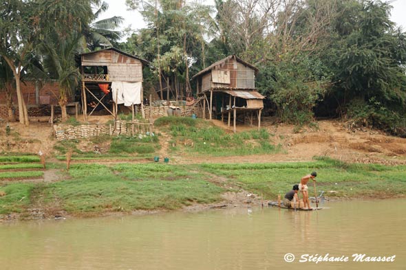
Overdiepse Polder, an infrastructure project in the southeastern province of Brabant south of Amsterdam, will have eight elevated farms.

The New Jersey Shore, hit by Hurricane Sandy. The Netherlands� approach to rising waters might provide valuable lessons for New Jersey and New York.
By MICHAEL KIMMELMAN
OVERDIEPSE POLDER, WASPIK, THE NETHERLANDS � When Gov. Andrew M. Cuomo of New York proposed the other day to spend up to $400 million to buy and raze homes in the floodplains damaged by Hurricane Sandy, I thought of Nol Hooijmaijers.
Some dozen years ago the Dutch government ordered Mr. Hooijmaijers to vacate the farmland that he and his family shared with 16 other farmers so it could be turned into a river spillway for occasional floods. I visited Mr. Hooijmaijers recently. He and his wife, Wil, served coffee in their new farmhouse and showed off the new stall for their cows.
How they and their neighbors responded to that government order, and how in turn the government dealt with their response, is a story that might now interest Mr. Cuomo and other New Yorkers.
It has been to the Netherlands, not surprisingly, that some American officials, planners, engineers, architects and others have been looking lately. New York is not Rotterdam (or Venice or New Orleans, for that matter); it�s not mostly below or barely above sea level. But it�s not adapted to what seems likely to be increasingly frequent extreme storm surges, either, and the Netherlands has successfully held back the sea for centuries and thrived. After the North Sea flooded in 1953, devastating the southwest of this country and killing 1,835 people in a single night, Dutch officials devised an ingenious network of dams, sluices and barriers called the Deltaworks.

The Maeslantkering, the sea gate at Rotterdam.
Water management here depends on hard science and meticulous study. Americans throw around phrases like once-in-a-century storm. The Dutch, with a knowledge of water, tides and floods honed by painful experience, can calculate to the centimeter � and the Dutch government legislates accordingly � exactly how high or low to position hundreds of dikes along rivers and other waterways to anticipate storms they estimate will occur once every 25 years, or every 1,000 years, or every 10,000.
And now the evidence is leading them to undertake what may seem, at first blush, a counterintuitive approach, a kind of about-face: The Dutch are starting to let the water in. They are contriving to live with nature, rather than fight (what will inevitably be, they have come to realize) a losing battle.

An illustration shows Overdiepse Polder, far left, in a normal state, and with floodwaters.
Why? The reality of rising seas and rivers leaves no choice. Sea barriers sufficed half a century ago; but they�re disruptive to the ecology and are built only so high, while the waters keep rising. American officials who now tout sea gates as the one-stop-shopping solution to protect Lower Manhattan should take notice. In lieu of flood control the new philosophy in the Netherlands is controlled flooding.
Governor Cuomo�s plan would turn properties in Queens, Brooklyn and Staten Island into parks, bird sanctuaries and dunes that could act as buffer zones for inland development. The idea is to give homeowners an incentive (perhaps up to $300,000) to move voluntarily out of areas where, in hindsight, single-family houses shouldn�t have been built in the first place. The Dutch have pursued a more aggressive and complex relocation strategy.
They are, by temperament, almost as allergic as Americans to top-down programs that impinge on personal and property rights; but water safety trumps pretty much every other priority in a country where 60 percent of the nation�s gross domestic product is produced below sea level. Protecting the country from storms and floods isn�t treated here merely as a burden or a political football but as an economic and architectural opportunity.
The local buzzword is �multifunctional.� The Dutch are putting retail and offices on top of new dikes, designing public squares and garages to double as catch basins for rain and floodwater, constructing floating houses and reservoirs that create recreational opportunities.
I enlisted Tracy Metz to help me find useful lessons for New York in the Dutch example. An architecture critic based in Amsterdam, she is the co-author, with Maartje van den Heuvel, an art historian, of �Sweet & Salt: Water and the Dutch,� which should be required reading these days. Ms. Metz called in some Dutch officials and architects, and she took me to see the Maeslantkering, the giant sea gate guarding Rotterdam, the last of the Deltaworks, as big and spectacular as a pair of Eiffel towers, on their sides, which slide closed.
Europe�s busiest port and the Netherlands� second biggest city, Rotterdam lies some 20 feet below sea level, so it relies on this immense barrier � and, it turns out, on faith. Rotterdam, in fact the whole of the Netherlands, has no evacuation plan should the floodwaters breach the levees, a calamity that could dwarf what happened in New Orleans. If Americans spend too much energy and capital on emergency relief and recovery after disasters have already struck, and not nearly enough on anticipating and mitigating trouble, the Dutch have achieved so much for so long in flood prevention that much of their population, even in sitting-duck places like Rotterdam, has been lulled into complacency.
That said, American politicians, including those who argued to cut back on money for preventive measures after Sandy, might want to see how the Dutch have managed to improve public life, public space and the landscape at a fraction of the billions American taxpayers pay out for repairing hurricane damage.
A good place to start is the newly completed waterfront development at Scheveningen, a coastal district of The Hague, where the Catalan architect Manuel de Sol�-Morales and his firm fashioned a dike into a graceful, snaking seaside boulevard, nearly two miles long. Even in the freezing cold I saw crowds strolling the boulevard, the Netherlands� version of the Coney Island boardwalk, designed so that the pedestrian bridge leading from the beach to the city will break into harmless pieces in the event of a catastrophic flood.
The centerpiece of Dutch water management now is Room for the River, a decades-long $3 billion program. It consists of nearly 40 interlinked infrastructure projects to mitigate climate change along the rivers and waterways that weave through the Netherlands.
Dikes are being lowered, spillways created. Many of the projects have faced legal battles and predictable public protests. People are being uprooted, lands repurposed. But the benefits are clear and widely shared.
So, for example, West 8, the Dutch firm now reshaping Governors Island in New York City, won the commission to design the bridges and pumping stations for Noordwaard, a Room for the River initiative to convert a vast polder, half an hour�s drive from Rotterdam, into a reservoir for occasional controlled flooding. The plan recuperates what had been a natural lake centuries ago, colonized as farmland. Dikes will be adjusted; walking paths added; panoramic decks constructed on the stations, so that the whole area, while continuing to support farming, can become a destination for hikers, skaters and bicyclists.
Another Room for the River project is the Overdiepse Polder, in the southeastern province of Brabant, an hour�s or so drive south of Amsterdam. It gets back to where we started: where Nol Hooijmaijers and his wife live.
Polders are reclaimed marshes, floodplains and other low-lying lands, surrounded by dikes. By lowering the dike along the northern edge of the two-square-mile Overdiepse Polder, the Bergse Maas canal will be able to spill in, diminishing the water level in the canal by a foot, enough to spare the 140,000 residents of Den Bosch, upriver, in the event of once-every-25-year floods. By displacing farmers, in other words, residents in that city can breathe a little easier.
Naturally the project didn�t go over well with Mr. Hooijmaijers and the other residents of the Overdiepse Polder when it was announced in 2000, any more than it would go over well with homeowners on the New Jersey Shore or in the Rockaways if government officials ordered them to leave.
But here�s where the Dutch example is instructive. The government did not ask for volunteers to leave. It made a decision, based on real numbers and the economy of the area. The polder would be used as a spillway. The farms would have to go. The farmers would be compensated, but staying wasn�t an option: a tough, greater-good decision that American politicians tend to avoid like kryptonite.
Rather than try to sue for more money or fight the plan, as farmers elsewhere did over other elements of Room for the River, the residents of Overdiepse Polder came up with a novel idea: Yes, the polder would become a spillway but the government should build a number of mounds along the southern edge onto which a half-dozen or more of the farmers could resettle. The mounds would be large enough (roughly 20 acres) to accommodate new farmhouses and sheds, and high enough (20 feet above the level of the polder) to keep dry. There wouldn�t be enough room for 17 mounds, so some of the farmers would have to leave.
Constructing eight mounds, as it turned out, was the right number.
Mr. Hooijmaijers organized the farmers. Negotiations were grueling and took years. �Every farmer thinks he has the best farm in the world,� is how he put it to me. In the meantime one farmer moved to Canada. Another died. �We had been a village, a community, and then in a moment, when the government said, �You have to go,� you become each other�s competitors,� Mr. Hooijmaijers recalled. �But we came together, and the government was very reasonable. It wanted to help.�
Through the picture windows in the Hooijmaijers� new, airy, modern farmhouse, designed by Wil�s brother, an architect, I got a view of one end of the polder. In the other direction was the old farmhouse, cozy but cramped. With the money the government paid to buy and eventually raze it, the Hooijmaijers had a down payment for the new house, which they finally moved into toward the end of last year. �The lesson is that these things are not easy,� Mr. Hooijmaijers said, �but they work out if there is cooperation and participation.�
Another way to phrase it is that hard decisions need to be made to cope with rising waters and severe weather.
Notwithstanding the obvious difference between a group of farmers on a Dutch polder and communities in the Rockaways or Coney Island, good government makes those decisions while giving affected residents adequate knowledge and agency: the ability to make choices, and the responsibility to live by them.
Politically that may be trickier than commissioning sea barriers or making dikes into boardwalks or redesigning waterfronts and neighborhoods to accommodate floods and storms.
But it�s necessary. And it may be the most important lesson that the Netherlands has to offer at the moment.
http://www.nytimes.com/2013/02/17/ar....html?ref=arts


Comment